

Boating the Western New York and Ontario Canada area waterways
Thanks for stopping in and seeing what we are about.
I'm just an old grumpy guy that has lived and traveled this area all my life and wanted to share my knowledge of it. Please bare with me as I'm no computer expert, far from it.
I will be adding more info as I go, it is just difficult to do on this dang tiny phone.
Listed in the following pages are places that I have personally been to over my 50yrs of crazy life. I have NOT been paid or given free / discounted services for listing them here. These are strictly my experiences in using their services.
At any point in your travels in WNY or southern Ontario, if you need assistance please contact me. I have lots of connections; I'm a volunteer fireman; former EMT; I have access to a new wheelchair van; Years of boating experience.
I own waterfront property on the WNY canal. I have let people camp here and park their trucks and boat trailers here.
I'd love to show you around my neck of the waters.
Thanks
*Also if you live around any of the NYS Canals or areas in Canada that I don't cover and want to share your info, I'm interested in adding more sections here. I would love it and will give you full credit for the info. It doesn't pay anything..lol. I pay for this site out of my pocket and don't charge anyone anything for it. I just like having info quick and easy, plus sharing it to others. Let me know.
*Please click on the menu button in upper left corner, if you are viewing this on a phone. Goofy three bar looking thingy. All the info is up there. Thanks
the Great Loop...
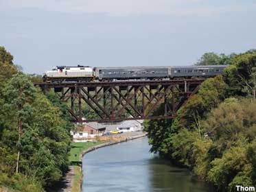
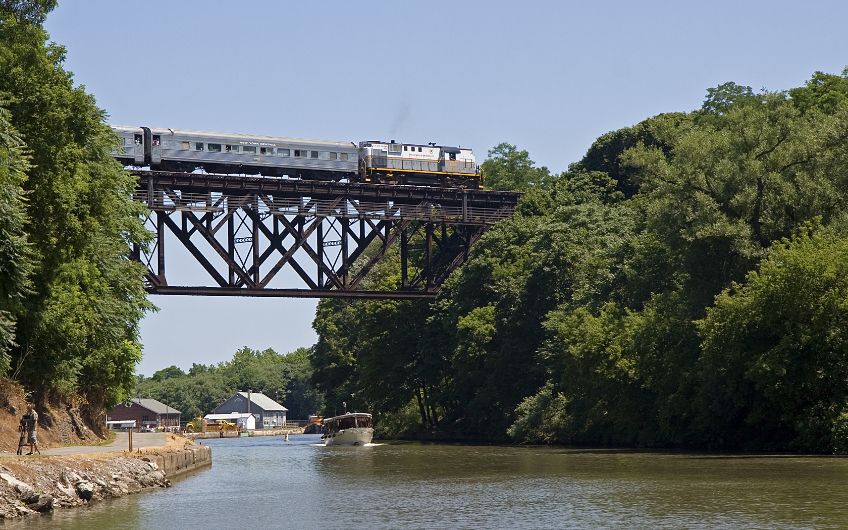
This website is mostly about traveling the "Great Loop'' and covers info of the western Erie Canal in NY and the Welland Canal in Canada.
From the 'Three Rivers' in the Phoenix NY area, to the Niagara River in Tonawanda NY, it is 179 miles. That is basically what is called the western Erie Canal. I list the stops from Fairport NY to the Niagara River which is around 100 miles. I have about 50 *free dock and wall spots along this section. Which gives you just about a stop every two miles. It gives you a chance for a break or if you have dogs onboard, some relief for them. Some of these are overnight and reprovision spots. I have also added a few anchor areas that you could possibly overnight at. They give plenty of room for passing boats and safe from issues on land.
*some do charge a minimal fee, like Lockport Widewaters is $0.25 a foot.
Ok so more details of this quest ...or adventure...
Well there is the Great Loop and sort of Mini Loops and Side Routes to discuss too. It gets a little confusing and of course everyone has differing opions of such. You are hopefully enjoying a ''docktail'' while going through this info.
The Great Loop has no begining or ending. It is where ever you first cast your lines and head in a direction till you come back around and cross your wake. For me that will be lets say Buffalo NY to make it easy.
Again another contention is direction. Most loopers travel counter clockwise because of flow of the rivers heading south and the Atlantic flow headed north.
Also most loopers follow the seasons and are south for the winter. It kind of goes with the canals in the north being closed and drained to help protect them from harsh freezing.
Sorry about this long winded explanation below. Everytime I meet someone new or heck, I even have to tell it again to family members. They just don't understand what the loop is. So now I can tell them, just go read this.
Leaving Buffalo NY and headed west thru the Great Lakes (Erie; Huron; Michigan - sorry not Superior) past cities like Erie; Cleveland; Detroit; Green Bay; Milwaukee; to Chicago. The lakes can be as flat as the pool in your backyard at times and then rage into 20ft seas with waterspouts chasing you.
Chicago you can take two different routes depending on your air-draft. The premium route is the Miracle Mile, right downtown. Gives you all the skyscraper and bridges views. After that you are on canals and Illinois River that takes you to the Mississippi River.
St Louis is the next major city and right past the Arch. *Don't forget the photo-op. Then you continue south to the Ohio River. *Decision time - either continue south on the Big Muddy (lots of huge barge traffic / less marinas and fuel stops / rough waters) OR the preferred route to the east. You head up the Ohio to a city called Paducah. *Decision Time again - taking a Side Route up the Ohio River to explore to cities like Louisville KY; Cincinnati OH; to Pittsburgh PA. OR in Paducah head south into the Kentucky Lake.
Wait, another *Decision Time, in taking another Side Route if you head to the Barkley Lake to the Cumberland River. That will take you into downtown Nashville TN.
Back to the Kentucky Lake and south on the Tennessee River. When you come to the state corners of Tennessee; Alabama and Mississippi, you take a westward opening which brings you into the Tenn-Tom Waterway and the Tombigbee River. You are kind of away from any major cities the rest of the way in this section, till you come into Mobile AL.
Now you have to wait for a weather window. You are about to cross the Gulf of Mexico. Most loopers take a direct route from Mobile to Clearwater FL. You travel down the west coast to Ft Meyers. Again a Decision Time, take the route thru Florida on the Caloosahatchee River into Lake Okeechobee and out the St Lucie River into the Atlantic Ocean. OR just keeping headed south for the Florida Keys.
There you go, you are halfway done. Now it's back to the North. All along the ICW (Inner Coastal Waterway) protected from the Atlantic Ocean. You pass cities like Miami; Cape Canaveral; Daytona; Savannah; Charleston; Myrtle Beach; Virgina Beach; Washington; Baltimore; Philadelphia; into New York City.
For me I will head up the Hudson River to just north of Albany NY, to get into the Mohawk River / Erie Canal. I then cross my wake and back at my home dock.
Mini Loops -
Like I said there are a few Mini Loops and Side Route trips that are part of the Great Loop. You kind of have to be able to travel into Canada to do a true Mini Loop.
The New York Mini Loops -
One is going up the Hudson River to Lake Champlain to the Canadian border. You are then in the Richelieu River to a city called Sorel Tracy on the St Lawrence River. Here you go east thru Quebec and around Nova Scotia; Maine; Boston; to NYC. OR west thru Montreal and avoid a 1,000 Islands and into Lake Ontario. Then south along the shore to Oswego and Erie Canal to the Hudson River again.
Another NY Mini is the Oswego across Lake Ontario to the Welland Canal in Canada. You are taken up to Lake Erie and a short haul to the western Erie Canal.
The couple Canadian Mini Loops are from Lake Ontario into the Rideau Canal. That takes you east to the cities of Ottawa and Montreal. The St Lawrence will bring you back to Lake Ontario.
Or the other Mini Loop is Lake Ontario into the Trent-Severn System which takes you westward into the city of Peterborough and the lift lock. Continue up to the Big Chute railway lock and dumped into Lake Huron. You then head south past Detroit to Lake Erie and the Welland, into Lake Ontario.
Almost forgot the Florida Mini Loop -
Lets start in Ft Meyers and head east on the Caloosahatchee River and to the Okeechobee. East to the St Lucie canal, in Palm City / Port St Lucie and out to the Atlantic Ocean. Turn south past Miami and around the Florida Keys. Try your best not to get hypnotized by the island lifestyle. Make your way up north in the Gulf to Ft Meyers.
So really when you think about it, my little spot of land where my lawnchair sits overlooking the western Erie Canal, I'm on just as an important spot as the most lavish docks in Miami. Those high falutin millionaries paying them association fees and conforming to their boards rules. I have them same yatchs passing by as I wave sitting here in my shorts. I'm on truly ocean front property, say a kin to internationally traveled waters. Looky there.
Here is a link to a map of most of the places that I have listed on this website. Sorry if it doesn't center correctly when first opened.
https://www.scribblemaps.com/maps/view/jPNudghFrb
Great Lakes Seaway map -
See boats in realtime in the Great Lakes and canals. Every kind of boat from pleasure craft to those 700ft+ lakers.
https://greatlakes-seaway.com/en/navigating-the-seaway/seaway-map/
NYS Canal on Facebook -
Follow these guys on FB for more info on the Erie Canal.
They don't respond to questions on their FB postings, but it gives you info on immediate closures and such.
https://www.facebook.com/nycanals
Also a great blog from a couple that accomplished the Great Loop is ''Travels of Conductance''. They did six years / 9,247 miles of the loop. Canadians that started from the Niagara Falls area. You can also find them on facebook Brenda Haskins LaPointe.
http://www.lapointes.ca/blog/?fbclid=IwAR1gXUWnDNr63Z9BcS5weBPQ7J02dF5QBoGjIvZk1YzPa_Zs_Az6cOcx0Us
Check this blog of an awesome boat that came thru the western Erie Canal. MV Scout / Lisa Hooper Henry. Love these folks that can write and describe their adventures along the canal.
Couple coming from Chicago headed to the Bahamas on their 38ft Island Packet Sailboat named Agape.
Read the section where they came through the Erie Canal and met up with this goofball at the laundry in Gasport.
https://www.facebook.com/share/p/8qjFw3cKxJTcfZgd/?mibextid=oFDknk
Two guys that are on their first trip around 2021. They are starting from Tampa to NYC. Then they will sit for the winter and start up again in 2022.
*...well they didn't make it and no so much friends anymore.
Marty Zoffinger on 'Kon-Tiki' - https://www.youtube.com/c/zoffinger
and his website - https://www.zoffinger.com/
Mike Steen on 'Good Times' - https://www.youtube.com/channel/UCqIsb2bERghO1ocZBf0xT9g
Take a look

Pirates-Chest.com
Our location and how to contact us...
On the Erie Canal
Gasport, NY
Call or text: email for phone number
*best way to catch me...
Email:
Facebook:
www.facebook.com/pirates.chest
https://www.facebook.com/profile.php?id=100014350205814
*worst way to find me. Still don't know how to tweet...
Twitter: twitter.com/PiratesChest1
*
*Watch
your wake!!!
Slow Please!
10mph
and less in some places.
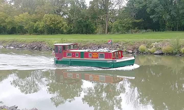
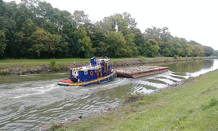
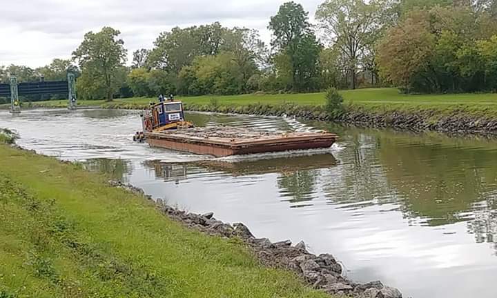
The western Erie Canal does have speed limits.
The Canal Corp staff at the locks and the lift bridges, actually keep track of your times passing thru. They contact the staff at your next stop, to let them know traffic is coming and to expect your arrival time. Some staff even operate two separate lift bridges.
Slow down.
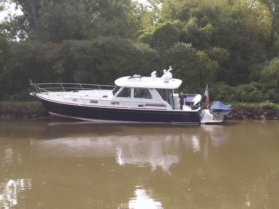
That pic above of the 65ft boat, is when they crashed up onto the embarrassment. Yes it happens.
https://www.canals.ny.gov/Boating-Information/Canal-Alerts/Message
NYS Canal Regulations §151.15 establish that the New York State Canal Corporation can fine mariners $100 and refuse lockage and bridge lifts for a period of six (6) hours
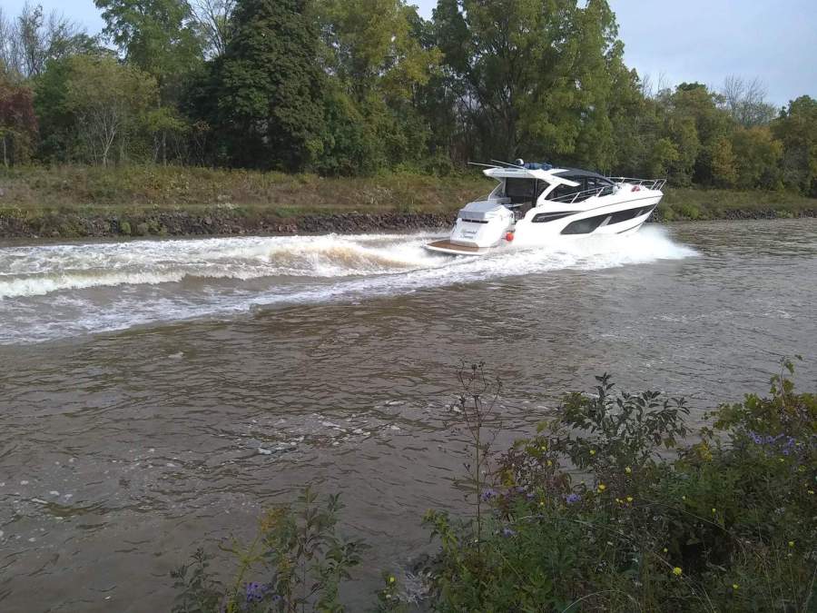
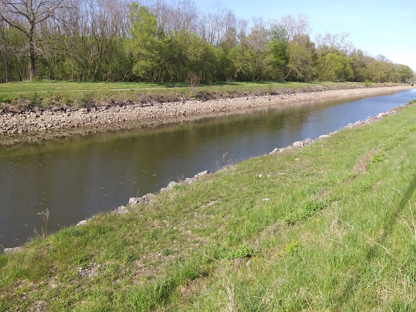
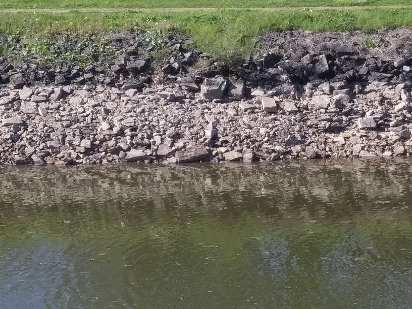
As you can see in the picture below, your wake goes up and into the rock embankment. Then washes the soil behind the rock out into the canal. That brown water is not from turning up soil below or from the bottom of the canal.
Turn around at your helm and look at the damage that you are creating.
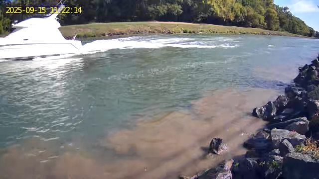
Also bank erosion.
Even though the banks of the canal is covered in large rocks, your wake is undermining it.
This is why we have these ''Guard Gates'' that you pass under every few miles. If the canals embankment has a blowout, these drop to prevent mass water exiting. It has happened.
Watch your wake.
*Please put contact info on your outdoor gear like kayaks; canoe; dingy; life jackets / preservers; throw rings; bumpers / fenders. Anything that can come off your boat.
The reason is, say if your kayak slipped off without you knowing and is found out by itself. Now local fire depts and the Coast Guard will be out looking for a potential water rescue victim(s).
These rescue teams can contact you without doing a massive search for a non-existing emergency.
We all want to find those in need of help, but wayward items just puts undue stress on resources.
Thank you.
Hungry??
If you are out on the Great Lakes or other waterways around them and looking to eat.
'Dock and Dine' lists eateries that you can easily access by boat. In most cases you can dock right there or it is a very short walk.
Check them out or send them a link to your favorite place for them to list.
https://www.dockanddineloop.com/
Hey, do you live on the Erie Canal or close by and want to be a local host?
Hosts help people on the canal like the walkers; cyclists; kayakers; boaters and others. All these groups are so different, yet use the same space here on the canal. Local people that live on the canal, see all the people and some want to help.
Mixed in the listing on the webpages here will be a few Erie Canal Hosts. They might have a private dock; a place to pitch a tent or RV spot; a parking spot for your car or trailer for an extended stay; a local onsite person to help with issues or as a guide.
Does that sound like something you want to assist with? Send me a message and I will try to explain the details better.
https://www.facebook.com/groups/NYSCanalwayWaterTrail/permalink/1015667725630626/
Do you need your boats AC unit serviced?
Located in Tonawanda NY, western end of the Erie Canal. Call Tim (716) 831-0333
Fellow big boat owner and good guy.
Need a Ford Bronco rental in Buffalo NY?
Here is an Airbnb for your stay..
https://www.airbnb.com/rooms/34679306?source_impression_id=p3_1659269464_Ss1rTD4ZUZcagkM1
How about do you need a campsite on the western Erie Canal?
You are in luck...
https://www.hipcamp.com/en-US/new-york/tomtuga-on-the-erie-canal/on-the-erie-canal-gvt-railroad
To you A-holes that are looking to break a made up "speed record" on the Erie Canal.... FUCK YOU!!!